Reservoirs and lakes
Lakes and reservoirs can be defined as a significant volume of water, which occupies a depression of the land and has no direct connection with a sea. They can intensify winter snowstorms, increase precipitation or/and surface temperature, generate night convection and intensive thunderstorms. Lakes and reservoirs can influence the atmosphere regionally and globally.
- Lake mask map In the LISFLOOD model lake mask map represents the area covered by lakes and is used for computing evaporation from open water surfaces.
- Lakes & reservoirs maps In the LISFLOOD model lakes and reservoirs maps represent only outflow location grid-cells (store lake/reservoir ID number in the morphological parameter look-up table) and are used for the lakes and reservoirs modelling.
Lake mask map
General map information and possible source data
| Map name | File name;type | Units; range | Description |
|---|---|---|---|
| Lake mask | lakemask.nc; Type: Float32 |
Units: -; Range: 0 or 1 |
Map of the footprint of lakes |
| Source data | Reference/preparation | Temporal coverage | Spatial information |
|---|---|---|---|
| Global Lakes and Wetlands Database (GLWD): Large Lake Polygons (Level 1) |
GLWD leve1 | 2004 | Global, 1:1 to 1:3 million resolution |
| Global Lakes and Wetlands Database (GLWD): Small Lake Polygons (Level 3) |
GLWD leve1 | 2004 | Global, 1:1 to 1:3 million resolution |
| Fraction of inland water | It can be prepared by using the methodology explained here |
NA | Global |
Methodology
Fraction of inland water map is adjusted to the LISFLOOD model – all grid-cells fully covered with ocean water that are considered during computations are filled with inland water.
If a grid-cell has any fraction of inland water and is inside the GLWD Level 1 and GLWD level 2 lake shapefiles, it is marked as ‘1’ (fully covered), otherwise it is marked as ‘0’.
Results (examples)
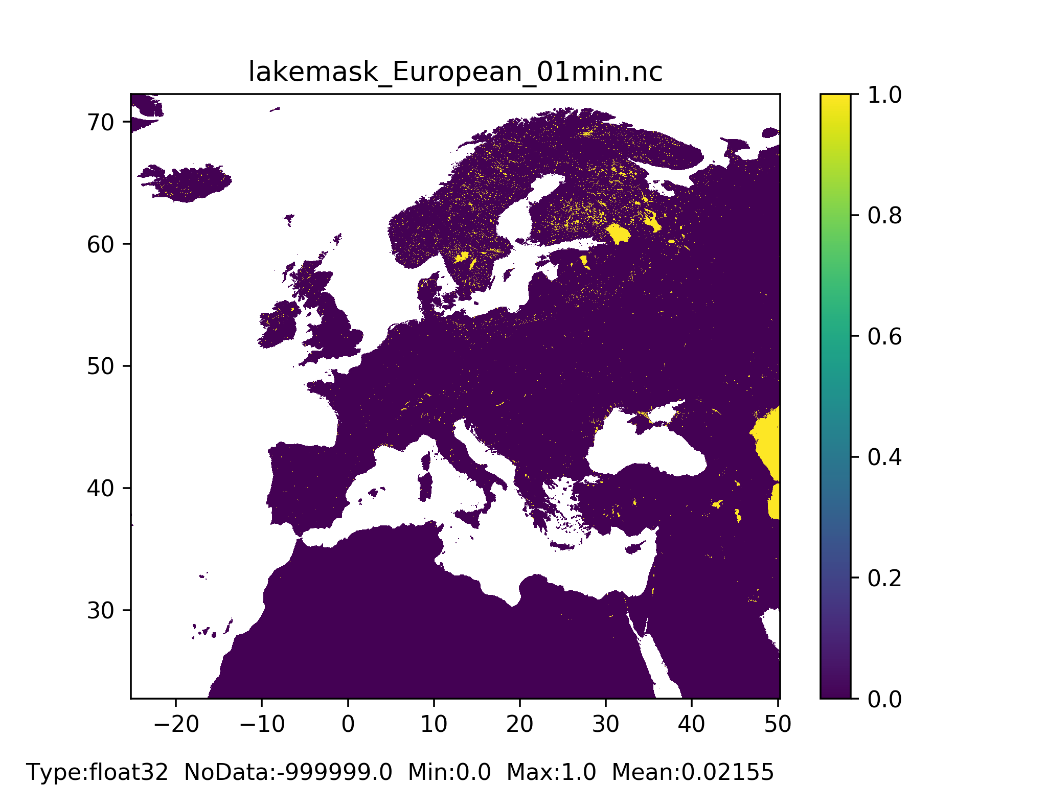
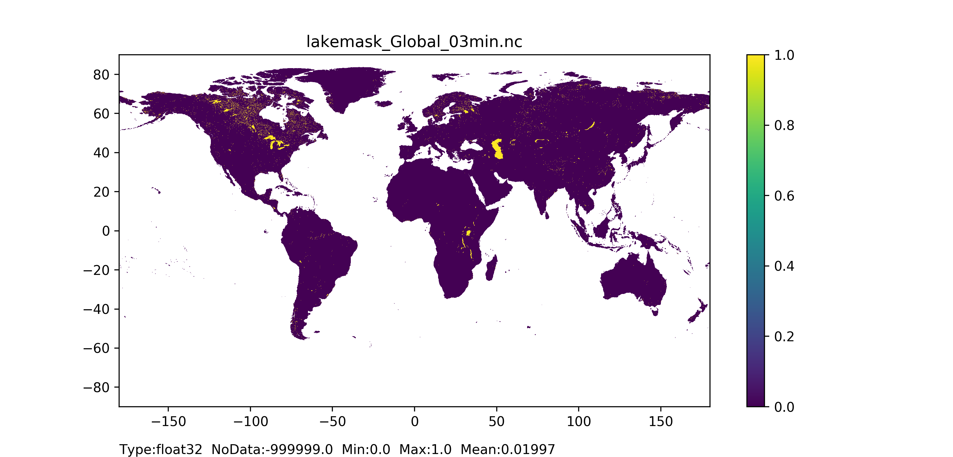
Figure 53: Lakemask map at 1 arc min horizontal resolution for European domain (left) and at 3 arc min horizontal resolution for Global domain (right) with coloured areas showing land pixel.
Lakes and reservoirs maps
General map information and possible source data
| Map name | File name;type | Units; range | Description |
|---|---|---|---|
| Lakes | lakes.nc; Type: Float32 |
Units: -; Range: integer ID number to identify each lake |
Lake outflow location (stores lake ID number in the morphological parameter look-up table) |
| Reservoirs | res.nc; Type: Float32 |
Units: -; Range: integer ID number to identify each reservoir |
Reservoir outflow location (stores reservoir ID number in the morphological parameter look-up table) |
| Source data | Reference/preparation | Temporal coverage | Spatial information |
|---|---|---|---|
| Lakes datase | NA | NA | European/Global, ASCII table |
| Reservoirs dataset | NA | NA | European/Global, ASCII table |
| Local Drain Direction (LDD) map | It can be prepared by following the methodology explained here | NA | Global |
Methodology
Any ASCII tables with lakes and reservoirs geographical location should be mapped on the local drain direction (ldd) map.